Sharnbrook in Domesday
In 1085 King William faced the greatest crisis of his reign. This came 20 years after his invasion and the conquest of England. He was vulnerable as his eldest son, Robert, was in rebellion and was courting allies in northern France for an attack on Normandy. Also King Cnut of Denmark was preparing to invade England in alliance with the Count of Flanders. William needed to raise an army.
 At Christmas 1085 he ordered an Inquest of all the land south of the Tees River. This was essentially a tax survey to establish what potential income could be raised and it took the format of a top-down data collection exercise across all manors/vills in his kingdom. The kingdom was divided into 7 circuits most comprising 5 counties. A Commissioner was appointed from outside the area i.e. they were neutral because they did not own land in that area. Bedfordshire was in circuit 3 with Cambs, Herts, Middlesex and Bucks.

The value of the manor was recorded 3 times: what it was at the time of Edward the Confessor (1046); what it was when it was given to the new owner after the conquest (1067) and what it was now (1086.)
The data was translated and recorded in the Great and Little Domesday Books. At this point the format or structure was changed so that it recorded all the lands owned by a named individual in order of importance i.e. it became an undisputable record of land ownership and strengthened their allegiance to the King.
Sharnbrook, then recorded as Sernebroc because the ‘SH’ sound was not translatable, was one of 145 locations recorded in Bedfordshire. Within the county there were 1200 Hides, 1600 Ploughlands and 102 Mills. The County was valued at circa £1000.
There have been many translations of the Books and several studies where the data is further analysed. For Bedfordshire the works of William Airey and Herbert Fowler are pivotal and some of their theories have been reflected in the following set of maps. The recent work of Andrew Lowerre at Historic England has highlighted how GIS techniques can assist with analysing historical data. Andrew was also instrumental in directing us towards the data sources available at Hull University where the database created by Professor John Palmer can be downloaded.
The QGIS software has been used to handle the subset of this database that relates to all manors/vills recorded within the Bedfordshire survey (it includes some manors now outside the current County boundary). A map of old parishes has been used as the basemap because this is thought to be a reasonable representation of the area/location of the manor/vills. For many parishes there is only one record i.e. one parcel of land and one owner/Tenant in Chief. However, there are also instances where a parish has many parcels of land with different owners. Sharnbrook itself has 11 records spread across 8 owners.
Willey hundred has records for 14 parishes covering 104 Hides, 120 Ploughlands and 8 mills. It is valued at £89 18s which makes it ranked only the seventh of the 13 Hundreds in the County.
Sharnbrook (probably including Souldrop) covered 10.3 Hides, 16 Ploughlands and 2 mills. It is valued at £8 19s which makes it ranked 3rd of the 14 parishes in the Hundred.
The following maps have been created using aggregate data per Parish:
The following map has been created using individual data for each record within the Parish:
| Sharnbrook Land Owners: their holdings in other parts of the County | https://slhg.org.uk/wp-content/gismaps/qgis2web_2018_01_06-16_58_00_779000/index.html#9/52.1158/-0.2870 |
In nearly all cases the quantity of land owned in Sharnbrook is a small proportion of their holdings across the County. In fact, a search of the PASE (Prosopography of Anglo Saxon England) database at Cambridge shows that the holdings in Bedfordshire are but a very small proportion of the land they own across the country. This can be illustrated by the full list of manors held by Geoffrey, Bishop of Coutances.
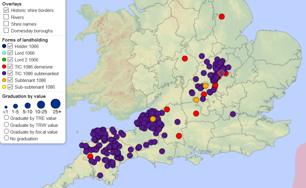
Geoffrey was the second most important of the Churchmen to have been allocated land in Bedfordshire. His lands in North Bedfordshire were dwarfed by his allocations in the West Country where their value was 50 times greater.
Even for small landowners like Albert of Lorraine the size of the land in Sharnbrook is small when compared to other lands in the County.
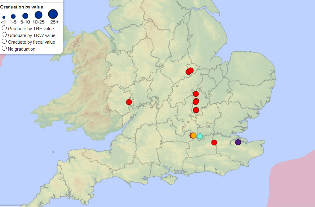
It is known that he was Lord of the Manor of Chalgrave even before 1066; he had served as a cleric to Edward before becoming chaplain to William.
Future Maps:
This approach could be extended to plot the allocations to other land owners in the County. It seems however that even the biggest landowners in Bedfordshire are of small importance when compared to other Norman magnates.
Recent Comments